
Summary: West USA
Keith flew to Los Angeles (from Japan) in the USA and rode across the continent. The first stage was a ride to Austin, Texas to visit his sister Debbie.
From Day 1 (November 6th) to Day 25 (November 30th)
West USA totals: 1766.4 miles, 59,520ft and 127:06 hours riding
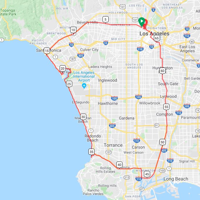
USA Day 1 Wednesday November 6th – LA Loop
It’s my first day riding in the USA. I spent yesterday evening putting the bike back together, adjusting bits and pieces, and re-packing my panniers.
I have a relaxed start as I’m nervous about riding in the US. Not sure why, maybe the drivers are poor and the roads I’m likely to ride on not so good. Also I read up on highway codes in the US and every state is different. Not helpful at all.
I get out on the road around 10:00 and my plan is to head for Santa Monica and Muscle Beach. It should be pretty simple, just follow the 3rd Avenue West. The roads are not great and there are numerous stop signs and traffic lights. I’m doing my best to be patient with them but I have an urge to jump them when all is clear!
An hour later I’m on the beach. I’ve not enjoyed my journey here but things will get better. The cycle path along the coast is very good. Not too many skaters or dog walkers. It’s overcast today so that may be the reason there are not so many on Muscle Beach and the volleyball courts. I’m enjoying the ride now, relaxing and taking in the scenery. I see seals off Manhattan Beach, the sun shinning and it’s a quiet path down as far as Torrance Beach. I cut inland at this point, 40 miles into my ride. That was all I set out to do.
The roads are busy now and full of trucks busy coming and going from the port.
Long Beach is my destination but I’m not liking the traffic it’s far too heavy. So I start heading back to downtown LA. It’s not long before the traffic improves and I’m cruising the downtown streets.
I locate a local bike shop and purchase an inner-tube, the guy has no WD40 or grease. But he tells me where to purchase the WD and gives me a knob of grease in tin foil. Nice man. I pop into the local supermarket to pick up tomorrow’s lunch and get the WD40. The place is full of Mexicans; I should have done Spanish at school!
Then it’s back to the digs where I have a bite to eat then sort the pedals out on the bike. I dis-assemble the cranks then clean, grease and re-assemble. Didn’t take long, all seems fine now.
I have dinner at Gut’s; burger, salad and chips, and then back to the Holiday Lodge motel; not the classiest of joints!


USA Day 2 Thursday November 7th

I’m all ready to depart at 7:00, packed and ready to roll.
Getting out of LA turned into a battle for the first couple of hours. It was all steep climbs and stop signs. I’m feeling tired from the start and the short sharp inclines aren’t helping.
I stop for lunch at a primary school sports field. It’s a wonderful expanse of baseball and football fields. All in pristine condition. Not surprising given the area they’re in. All the timeI’m under the watchful eye of the local Police. I pass Harvard University [this University is in Massachusetts! so not sure what this is: Ed] shortly after and on to the Electric Pacific bike trail.
It’s a lovely 10 mile stretch of new tarmac and I pass only three other people. I spot a cycle store (Don’s Cycles) so pop in and buy some grease for my bottom brackets. Don follows me out the store and spots my bike. We then have 20 minutes of me telling him where I’ve been and him advising me of where I should go. Lovely bloke, very helpful.
Once I clear LA the Lytle canyon is my next challenge. It’s 14 miles of twisted climbing to end my day. Not what I wanted as I’ve been feeling tired all day.
It takes me 90 minutes to cover the ground after fueling up at a coffee shop.
The Best Western hotel is a bit dated!


USA Day 3 Friday November 8th

I had a great breakfast this morning with make your own waffles included. The weather’s good again as I continue the climb out of the canyon. Train whistles echo up the valley as they also weave their way up. they are pulling hundreds of containers with their eight locomotives.
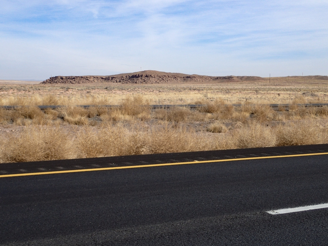
I drop down gradually and follow the “Old Woman Creek Road” along undulating highway with poor hard shoulders. Luckily the road’s not too busy. I’m making good time this morning and by midday I’ve got over 50 miles in the bag. I pull in to a large pile of boulders to seek some shade for lunch. It’s 30º now. It’s a ham and cheese roll, banana and apple and I’m refuelled.
About an hour later I pull into a layby to check out hotels. As I come to a halt a couple in a mobile home ask, ‘Tea, coffee or water?’. Turns out they were from Gouda (Netherlands) and are very nice and very chatty. They;ve been in the US visiting friends and touring for 6 weeks. After two bottles of water and a cup of tea we said our farewells.
I’m still not feeling great and my legs are aching on any sort of climb. Perhaps the two weeks off the bike hasn’t helped! No worries, I still did 85 miles today on some difficult terrain. Better tomorrow 🙂


USA Day 4 Saturday November 9th

No rush this morning as the outdoor shop doesn’t open till 8. I will need gas for the stove if I end up camping tonight. Good to have it onboard in any case.
I had breakfast at 6:30 then on to the grocery store (not the one I left in a storm last night!), I need plenty of water and food for a couple of nights. The ladies in the store are charming, loving my english accent and advising me where to go over the weekends. It’s Veterans Day on Monday and lots of celebrations in this gun happy state.
I check out the hotel all loaded up. I didn’t think I would be doing this again; 6 litres of water and plenty of fruit to go with the rations. About 8 miles down the road I pull up at the Outdoor Pursuits store. It’s busy with people buying all sorts of climbing equipment.
I soon locate the gas cylinders as the assistant comes over. She enquires if I’ve got the right ones and do I need anything else. So I spend the next fifteen minutes discussing wild camping, fires and the best route for me. Then she sorts out all my change for me like I’m a 12 year old (Dale’s old trick).
On the road with 40 straight miles and a tail-wind. Bliss. I had to stop a take a photo as I’m in Joshua city.
A couple of hours pass and I take a left turn and begin my climb into the next valley; I think a spoke went . It’s not too steep for 8 or so miles. The last couple ramp up a touch and its now over 30º. On the descent I spot a fellow cyclist resting on the side of the road.
Phil said he had been on the road for six days and this was his last. He was routing thru the Grand Canyon and onward to 29 Palms. He advised me that Route 66 was shut from Amboy for 40 miles although you could get through on your bike. Just a couple of bridges washed away, no worries. He also told me the petrol station was the last place for water and where he had camped the night before. I was hoping the gas station was a cafe and motel. When I arrived the owner explained he had only recently open the gas station and a small shop. I’m 65 Miles in and it’s only 12:30.
I rested here, drank plenty (no beer) and considered my options in the shade. Seems I had no option other than to camp.
I push on for another 20 before I spot the place to camp. Just came over the ridge so it’s in the shade and the sun will rise right in front of me. I get my breath back and cool down. Shopuld I fix the bike then put tent up or vice-versa? I fix the spoke first and the tent will go up in the dark. It’s not long before the rear spoke’s sorted. I get the tent up, then prepare dinner and coffee.
The gas canister fits, so I’m happy. The sachet of dried pasta is soon prepared with cheese and mushrooms with a couple of rolls and a large coffee. Splendid. Dinner in the dark and it’s only 17:30.
I’m into the tent to read and ready for an early start. It seems I’m going to be listening to trains in the distance all night 🙂


USA Day 5 Sunday November 10th

It was not a bad nights sleep but any kind of mattress would be good. Almost a full moon and as bright as can be at two in the morning. It doesn’t help when your trying to sleep for 10 hours on a rocky bed.
I’m active at 6 an have breakfast with coffee and all packed by 7. The rear tyre was flat?. Pumped it up and it seemed all good. I resumed on the closed Route 66 road. It’s not long before the closed road signs appear. No worries as I vear around the barriers, stay clear of the holes, and crack on. It works well for the first three bridges but the fourth bridge is completely washed away. No worries! I back track 40 metres and take the rough detour around the bridge. Thankfully the river is dry.
I didn’t see or hear anything for over an hour this morning but then I spot a fellow cyclist approaching. Steve’s a German rider who has come down from Canada and been on the road a similar time as myself. Nice chap and we exchange our local knowledge of water holes and food outlets. He’s heading down to San Diego then flying to New Zealand (warm weather). He’s very interested in my time in Japan and hopes to travel there in the summer. Even on a closed road these two cyclists move as a group of heavy motorcyclists are making too much noise.
The next point of interest was another classic 60s petrol station. I have a coffee and a sandwich 20 miles in. As I’m sat there viewing the table top maps of the local area a couple of ladies squeal about a spider under their car. I’ve got to take a look, it’s a Tarantula, pretty large and angry as I picture it. The ladies reverse out of the way being careful not to harm it. Advising me not to get to close as they bite and jump. A car pulls up at the pump, two large male locals. They look at me and ask what’s the problem? I say “take care as you get out as there’s a large spider in front of your car”. He gets out, looks and laughs. Puts his hand down and picks the thing up. So cool. Tells me no worries you can pick them up but don’t drop them as their abdomens split when they hit the floor.
Over the next few miles I noticed several more crossing the road along with many ground squirrels.
I made the decision to stick with Route 66, turning right instead of left. As I stood at the junction contemplating my decision a guy jumps out of his car and offers me an apple. Nice gesture, really not expected. It was a great downhill stretch into Needles. Where I’m booked into a room on the banks of the Colorado river. Turns out as not being on the bank, but it is cheap.
I’m out for dinner at the local cafe on the river, but it’s generally poor service and crap food. No wonder they’re not busy.
After a couple of beers I go back to my room to alter my routes to take in the availability of shops and accommodation. Looks like it’s three days to the Grand canyon south rim.


USA Day 6 Monday November 11th

It’s pasta for breakfast due to the fact I didn’t pick up any milk or yoghurt yesterday 🙂 No worries it’s just fuel.
I step outside and it’s bright but a cold 6º. I’m still wearing shorts and my atlas shirt (thanks again Dave). I may have to re-think the morning kit. It will soon warm up and anyway I’ll be climbing all morning.
It’s terrible tarmac for the first couple of miles through the village – a bit like Ukraine. It’s not doing my rear wheel any good either. Two miles in and I cross the Colorado River for the first time. It looks cold and grey and is running fast. It’s busy up through the towns as I stop off at Safeway in Bullhead City for the days supplies.
It’s seriously up hill from here for twelve miles. Thought these days were over and my legs certainly hoped so. It takes me an hour and half to reach the top and it’s a proper struggle at times; 3571 it says on the sign. I take it that’s feet, it is. Only 1088 metres. I have a bit off lunch; apple, cheese and a lovely baguette.
Then it’s a nice descent into Golden Valley knowing it’s a climb back out. No worries, stop for a cold drink and a chocolate bar in a petrol station. The place was full of war veterans in their roadster cars and Harley motorcycles. Expected more gung-ho stuff, but they’re super friendly.
The next climb’s not so bad, only 20 to goand the first 8 uphill. I can pretty much see the whole climb from the start, a dead straight line with a two mile dog leg to the top.
I soon arrive a my hotel. Nice and early 15:00. I need to be careful as it’s dark at 5.It’s a ground floor motel room again and I roll the bike straight in. Excellent.
I go to a Mexican diner next door for dinner. I’m spending so much time with the Mexicans I’m thinking of growing a moustache [Well it is Movember: Ed].
I’m a bit disappointed tonight as I tried to arrange my first Couch Surf but the host wasn’t available.
Definitely on the cards soon though.


USA Day 7 Tuesday November 12th
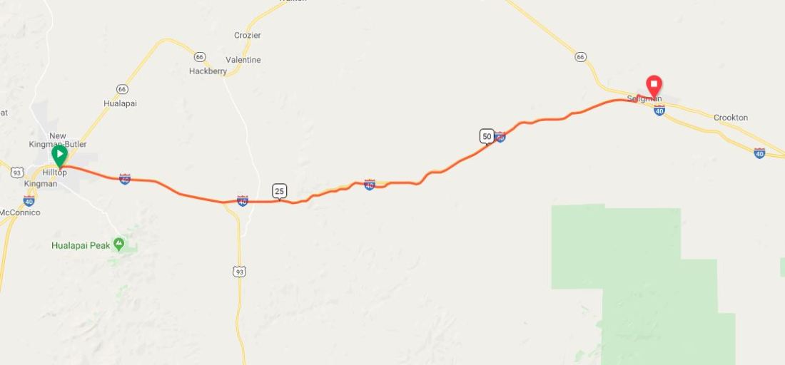
I Crossed the border in to Arizona yesterday afternoon so the clocks go forward an hour. I have breakfast in the motel at 6 and it’s still very dark so I got all my gear ready to go but it is to dark still at 7. The sun’s creeping up and I set off at 7:20, still early.
As I climb out of Kingman I’m aware that the sun is rising directly in front of me. This means the drivers behind are dazzled by the sun and won’t have a good veiw of me or the road. So I stop and put my rear lights on. It’s cold and the hard shoulder is only a metre wide and very uneven. Not a good start to the day.
An hour later and it’s all change the sun has risen, it’s not so cold and the hard shoulder is wide and smooth. It’s rolling roads for the next couple of hours and the miles are easy.
At 10:30 I stop for some food and a rest. I perch myself on some boulders overlooking the highway, with a great view across the valley. Truckers are honking their horns as they pass. Not much happening today, the roads are quiet and I’m pleasantly buzzing along.
Not far to go now so I pull of the highway onto the original Route 66. On pulling into Seligman the high street is like a scene from a western movie; saloons, barbers and a Sheriff’s office. I decide to have lunch in the Roadkill cafe/saloon. It’s typical American stuff. A large wooden bar, ranch style restaurant, stuffed animals and more shit than you can imagine; T-shirts, fridge magnets, teddy bears and a whole lot more.
It’s only 2 mile to my motel. The lady is multi-tasking today she tells me. Running the bar, office and serving pizzas. I’ll be seeing a lot of her tonight :).


USA Day 8 Wednesday November 13th

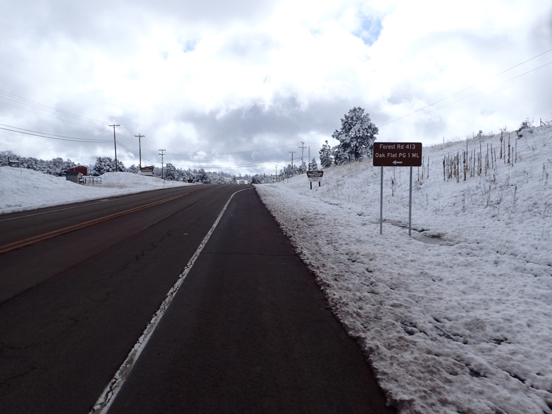
I pull out of the motel at 7:15. the roads are white with ice. I’m not liking this. Two routes this morning 70 miles and not a lot of climbing up through the local roads or, 94 miles 1000 metres of climbing but clear on the maps.
I turn left for the short option. After only 800m it seems the left turn is via a farm with large no entry signs all around. Plus pictures of firearms. Not for me, so I do a U turn and prepare myself for the 90+ miles. I have to pull over and put on my gloves for the first time. Not a great start.
It’s cold but dry so I get my head down and my first stop is Ash Fork. I need to pick up water, I have food onboard; bread and cheese. 20 miles in and I ride through Ash but it’s too cold to stop, even though I’m climbing. The next place is Williams at 40 miles. This place is just made up of Disney like saloons, hotels and garages. I pull over at a garage and get my water, chocolate and sprite. It’s 50+ miles to go from here but I’m making good time. I turn left and this is the road to the canyon.
I take off my jacket and gloves but it’s still a chilly head-wind. It’s just a long undulating road ahead, slowly climbing.
The sky is blue and looks very warm. Not so, my feet have been cold all day. Nothing to do with the fact I’ve had these summer socks on since Poland. Time to change maybe!
It’s not a hard ride this afternoon as I made good time this morning so I’m not worried about it getting dark. I planned to finish around 4 but I should be done at 3.
The ground floor room at the motel allows me to roll the bike straight in. Cool, going to go over the bike tomorrow and visit the canyon.
Dinner is in the hotel with a hundred German tourists. All good fun.


USA Day 9 Thursday November 14th

Fly-through Map USA Day 9 Helicopter flight.
Fly-through USA Day 9 cycle and hike.
I’m up early for a very busy day. It’s a great start with breakfast with the Germans, and the waiter thinks I’m part of the tour group. No complaints. I remove all the baggage from the bike.
I leave for airport at 8:00. Arrive at 10 past. Looks like I’m first here. I watch the crew do their safety checks, before they go through the safety briefing.
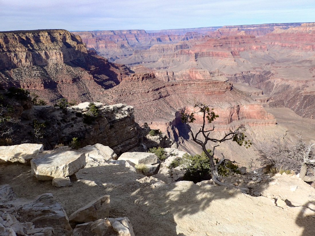
I’m sat in the front right side. Great seat. The rotors are running and the captain introduces herself to each of us. It’s gentle take off and we head across the forest. Probably only a hundred feet or so above the trees. Clear blue skies and the rim of the Canyon on the horizon. We don’t seem to be going very fast as we near the rim. WOW what a surprise, the depth and size as you come over the rim is amazing.
The river runs off to the north and the colours are amazing. Dale the pilot is answering questions and briefing us on directions and place names. It’s a truly awe-inspiring sight. The vastness is amazing. Dale completes her route over the next 30 minutes. Briefing us on names and formations as we circle the canyon. On the way back to the heliport she points out herds of buffalo roaming below. I’m soon out of the helicopter and keen to get back to the canyon.
First I’m up to the tourist info office on the bike. The park pass is twenty dollars but valued for seven days. Well worth it. The assistant explains everything I should do in the park, bombarding me with masses of information. I finally get away and ride up to the entrance. Two miles to the park and another three to the south rim.
I get a good view of the Canyon and a couple of shots of my bike in the foreground.
I take the bike down to Bright Angel trail head and lock it up. It’s a 10 mile hike along the rim to Hermits view-point with other view-points dotted along the way.
It’s a paved path with barriers at the more vulnerable spots. All immaculately clean, not a drop of litter to be seen. A far cry from China and the Stan’s.
It’s busy to start with but as I get further away from the gift shops and cafes I’m practically on my own.
The views are stunning and the Condors have appeared also. Gliding on thermals without a beat of their wings, there is also a few smaller birds about, but most have migrated south at this time of the year.
A coupe of hours into the walk and I spot a “Mule Deer” a huge animal just sat in the brush about 10 metres off the path. It takes a little time before I realise there are three of them spread over a small area. They don’t seem bothered by my presence at all and I’m within a couple of metres.
Finally I arrive at the Hermits Rest the end of this trail. I jump on a courtesy bus back to Bright Angel to pick up my bike.
I haven’t eaten since 7 this morning and its now nearly 5pm. Do I head back or eat and ride back in the dark? I eat and a couple of beers. Put my rear light on and set off home the 8 miles or so. The car drivers leaving the park are very courteous and leave me lots of space. It’s downhill and I’m in a hurry, as I speed along a herd of the Mule deer cross the road, at least two with a grand set of antlers. I’d best calm down as I wouldn’t want to run into them. Soon home safely to go through photos and videos before I shower and eat. PASTA and PIZZA not a place I’d recommend.
Excellent day.


USA Day 10 Friday November 15th
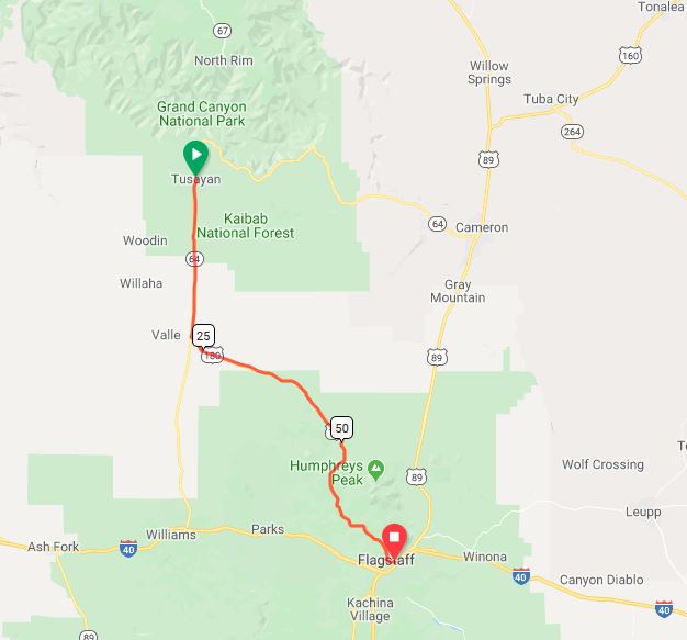
Breakfast in the hotel again this morning. Only difference, I had to pay for it. Book out out 7:30, cold and overcast, got my gloves and jacket on already. First 30 mile is a reversal of my entry to the park. Left turn and I’m off down the Fort Valley road scenic route. Passing Red mountain on my right as we trundle through Coconino National Forest.
Take a break at 45 miles, nice little picnic on the edge of the forest. Spotted a Greater roadrunner as I relaxed. (Geococcyx californianus)
Rolling hills are getting a little tougher now, head wind is trying me. Just push on!. After 15m things change around. Long downhills and the wind on my back (sometimes). Not long before I’ve entered Flagstaff, altitude 6906, Founded 1882. That’s what it says on the sign.
Lovely steam engine as we reach the centre. Turn right and head out of town, I know there’s a whole street of motels along this way. Just as I’m about to leave town I decide on the Western hills. Nothing smart, ground floor and clean. Plenty good enough for me.


USA Day 11 Saturday November 16th

Fly-through Map of USA Day 11.
Breakfast on the bed this morning; muesli and yogurt and some fruit. On the road as early as possible today. 95 miles and I’d like to video call Dale later.
Head out at 7 with my damp gloves on. Due to health reasons I had to wash them last night!
I’m straight out onto Highway 180, Route 66, Purple Heart trail; it’s all the same road. Nice and flat and with a wide hard shoulder. In fact it’s slightly downhill and no wind. Excellent; I’m flying and after calling in for water my average speed is in the low 20s.
It’s prairie to both right and left with the odd large rock outcrop. It’s proper Indian country especially when combined with the town names “Two Arrows” and “Two Guns”.
Navajo Nation is to the north and Fort Apache Reservation to the south.
After three hours I pull over for a hot drink; it’s still very cold and the sun hasn’t broken through yet.
I give Linney a call to catch up with what’s happening at home and to say I hoped to call later whilst he’s at Dale’s birthday party.
Only 30 miles to go. Long flat straight roads and I’m booked in to another motel within 2 hours. I’ve averaged 18 miles an hour today. Happy.
I give Dale and the lads a call at the Ratling club, but it’s all very chaotic and on a poor line.
Hope you had a great night Dale and not to much to drink. [Lovely night. Lot’s of People. Many thanks to all those who made the effort: Ed]


USA Day 12 Sunday November 17th

Fly-through Map of USA Day 12.
I was up early as normal and had breakfast in the Mexican restaurant next door. Not sure why I bothered it was bad. Egg, tiny sausage and a slice of white toast.
I get on my way knowing it’s a 90 mile ride again today, mostly slightly uphill. I’m back onto Route 66 and after half hour I get a puncture. My first in the USA. I soon have it sorted and I’m fretting about how long my day’s going to be already.
It’s praires on both sides again and not a lot to take my mind off the miles. A couple of young jack rabbits running around is an improvement anda large bird of prey lets out a screech as it takes flight. It’s not long before I’m 50 miles in and I pull over for some lunch. The ARMCO barrier gives my somewhere to lean my bike and rest on. Not the most picturesque place.
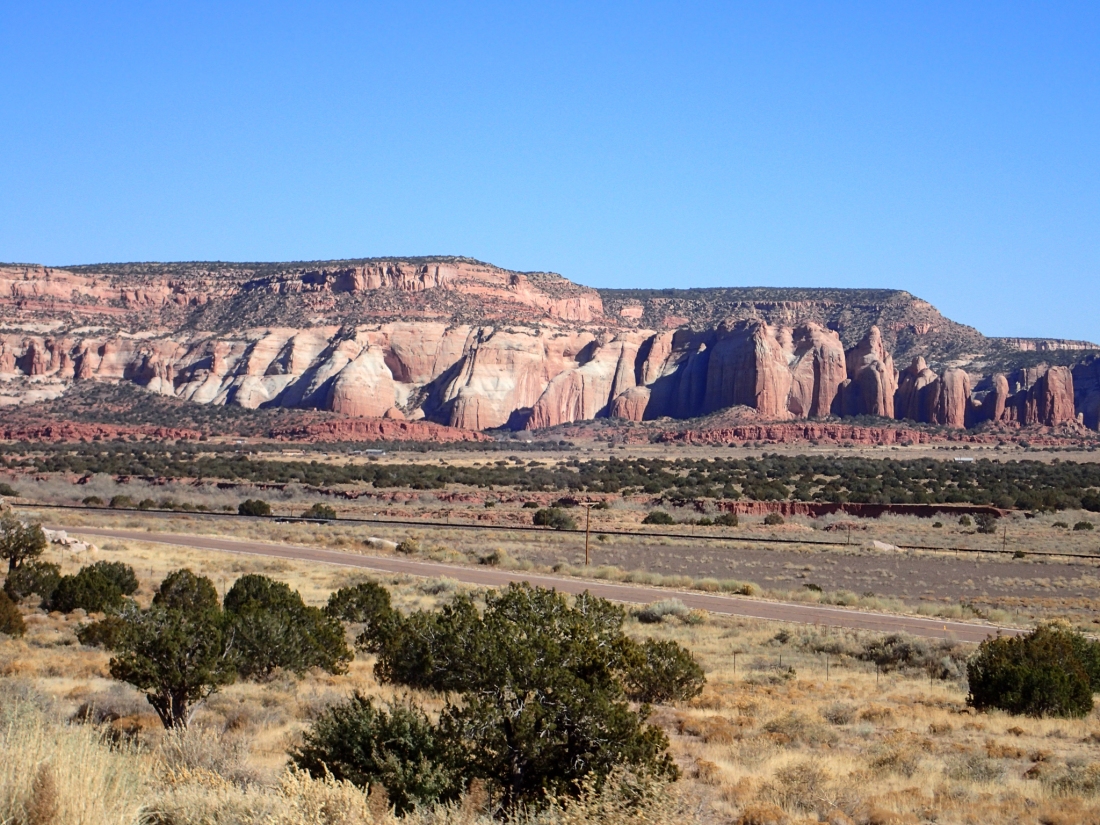
Later the scenery changes a little with lots of stone escarpments on either side of the road. Someone has actually adorned the cliff faces with Indian mannequins. It feels like an arrow is going to cross my path at any moment.
It was a pretty dull day today, but 95 miles clocked up. I spend the evening repairing inner-tubes and going over the bike. The rear wheel isn’t looking good.


USA Day 13 Monday November 18th
It’s very cold this morning. Clear blue skies and icy roads.
The first couple of miles is up hill which is good as that will get my temperature up. Generally it’ll be slightly downhill most of the day. It’s ok when you’re in the sunlight but the shadows are cold.
I don’t seem to be able to get going this morning. After two good days maybe I’m tired! An hour in and I get a puncture. No worries I’m in direct sunlight and it’s quite warm.
The surroundings are similar to yesterday; prairie to both sides and advertising hoardings for Indian rugs, blankets and jewellery. All the genuine article, maybe.
As I cross one of the junctions the tarmac jumps up, I hit it pretty hard, and I hear a ping from the back wheel. I carry on enough to clear the junction before I stop and take a look.
It’s not looking good; one broken spoke and one spoke nipple pulled out of the rim. This added to the temporary spoke is critical.
I take my lunch whilst going over the scenarios. Hitch a lift, phone for help or ride on and see what happens. It’s only 24 or so miles. So I set of riding as carefully as I can Counting down the miles. Strangely I get a beep of the horn and a big wave of encouragement from a passing driver. Don’t get that too often here. Thought about trying to flag him down but he’d gone.
The scenery changed a little, forest to my right and a huge cliff face to my left.
I limped into the motel feeling sorry for myself. Booked in for two nights, I’ll have a beer or two tonight and mull things over. It will be fine tomorrow. Seems the nearest bike shop is back 60 or onward 90+.
Tomorrow’s another day.


USA Day 14 Tuesday November 19th
[No cycling today as Keith ponders how to get his back wheel fixed: Ed]
A rest day today. I walk into town and visit the Uranium mine and two breweries.
I leave the hotel just before ten and pick up from the parking lot a pair of “Raybans”. They are very nice and the sun is shining.
So I’m walking down the high street in my shorts and Raybans, bright sunshine and about 5º. I look like a local.
It’s a 2 mile walk to the museum. When I arrive the guy is very friendly and interested in my previous mining history. We chatted for some time before he sat me down and showed me the introduction film. Then you’re on your own. You call the lift (man-rider) and go down to the mine itself. At points throughout the tour there are buttons to push that give you a commentary on what’s happening in the area. All by a former workers.
The set up was very familiar to me and a lot of the machinery was what I had worked with in Kent. In fact the battery lights and self rescuers were identical. It took me a couple of hours to make my way around completely on my own. A great experience.
When I returned to the surface I joined a group of older local folk interested in the mine because their fathers had worked in the uranium business. Which shut down in the US around 1986-7. The same time I came out of the coal industry.
I made my way to the Route 66 scrapyard brewery on the way back. Nothing new here apart from the fact it was situated in a scrapyard.
From there to the Elkins Brewery Company, nice couple of beers here. Sampling 5 or 6 of their brew. All very good but I need to get back and sort my bike out and make plans to move on.
Decision made, cycle 70 miles tomorrow on my broken wheel. As my brother would say ‘Faint heart never fxxxxx a pig’. I’m going for it.


USA Day 15 Wednesday November 20th

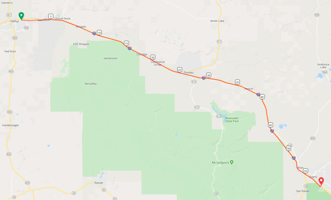
Route USA Day 15 – November 20th
Fly-through Map of USA Day 15.
Breakfast is in the hotel. I ate every thing I could. It’s raining outside and cold. If my wheel breaks down today I’ll could be stood on the hard shoulder for some time.
I cock my leg over the saddle and set off. I’ve gotten rid of anything I can to keep the weight to a minimum. I’m not carrying food or water, well one bottle of water.
It’s 70 miles mainly down hill with a bit of a climb towards the end. I set of gingerly avoiding any changes in the tarmac, avoiding all pot holes and debris. It’s a shaky first hour or so.
I get a few toots from passing drivers appreciating my efforts in the rain. I’m starting to relax now and pushing a good average speed (17mph).
I didn’t stop for five hours and smashed the ride and arrived at my hotel at 12:30 dripping wet. I’m not allowed to my room till 15:00. No worries. I set up my laptop and picnic in the lobby. Helping myself to coffee and pinching the sweets off the reception. The soon give me my key.
It turns out there are half a dozen or so cycle shops in town and Kristian as been ringing around for me.
After warming up and eating I decide to take my bike to “FAT TIRE BIKES”. I’d spoken to them on the phone and they’re very helpful. Its another 12 miles to them but it’s dried up a touch now. It’s an excellent route mostly on cycle paths and following the “Rio Grande river” for a couple of miles.
The staff are super friendly and eager to help, especially Sharon and Clint. They have a 36 hole rim, so we agree to rebuild using my hub with new spokes and rim.
It’s ready the following morning. Excellent.


USA Day 16 Thursday November 21st
[No cycling today either: Ed]
I have a relaxing morning as the shop doesn’t open till ten. Snowing outside. I order my “UBER” cab and I’m at the shop at 10:03.
It’s all good, they’ve done a great job and I’m back on the road. I leave the shop in the rain and make my way to REI. I’m in need of some warmer gear. I pick up a snood, winter socks and a Therma-rest air pad for camping. I refuse to sleep on the floor when it’s this cold.

I make my way down to the “The National Museum of Nuclear Science & History”. This place is pretty amazing but also a lot outdoors. Cold and wet. I’m not hanging around.
Down town to the “High Noon restaurant” as recommended by our friend Paul. Excellent lunch (Tacos). Time to get back to the hotel and warm up. Clean the bike and repack my bags to make room for the new airbed,
All sorted but it took me longer to clean the bath after than it did the bike. I popped down the shop to pick up stores for tomorrow and had my haircut, Burger, beer, fries.


USA Day 17 Friday November 22nd

Fly-through Map of USA Day 17.
I’m up early to check the weather; it’s cold and damp. Better than expected. Breakfast in the hotel is nothing special.
Decided I’m only riding 70 today what with the new back wheel and things. The only other option is 110, and that’s a struggle in the cold.
I set off through the town for the first ten miles (should have moved hotel yesterday). It’s a steady climb out looking up at the snow topped peaks. Just a flurry I say to myself.
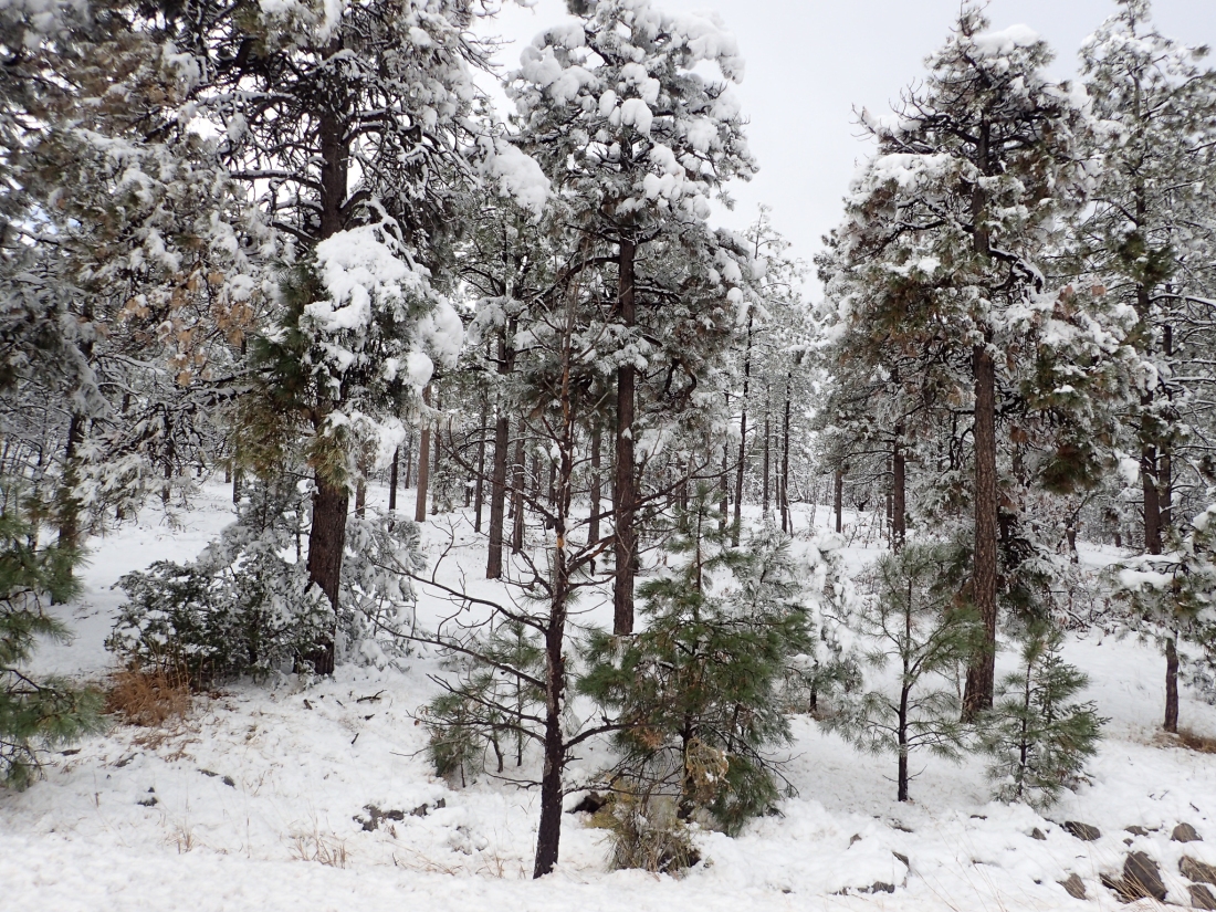
The climb’s longer than I thought, pushing and pushing. The snow’s getting more intense. Cars are approaching me with 4 inches of snow on them. I’m a little apprehensive to say the least. It’s a great ride; I left the Route 66 at the 20 mile mark and I’m now on the “Salt Mission trail”. It’s a lovely twisting road up through the mountains. What with the snow I could be in the Alps. The climbing is easy and generating heat. Only my feet are cold. The descents are freezing and my eyes are watering. I can’t see the Garmin never mind the road. Dave’s glasses will have to go. I’ve got my new “Raybans” now.
After the mountains we’re on the rolling plains, but still patches of snow about and the wind is cutting across my shoulder. The small section I rode into the wind almost brought me to a stand-still. The roads have been good and clear of snow all day. The Garmin says go left, I look and it’s a track. I follow the Garmin but after a couple of miles the sign reads “Dead End”. I do you a U-turn and retrace my route. Three dogs appear as if from no-where. No worries they’re too far behind and not barking? No they’re not, they are level with me and looking to have a go. I’m flat out; They chased me all the way back to the junction. At least I wasn’t cold anymore but I had to get off and recover for a minute or two.
No worries; a quick look at the map and I’m 16 miles from home.
It’s a strange 1920’s hotel. The room is freezing and dated. The heater does work, just not been on for a couple of years. Dinner in the hotel, it shuts at 6. Meat loaf, mashed potatoes and green beans. Wonderful, just what I needed.
The bike was good today, along with the scenery.


USA Day 18 Saturday November 23rd

Fly-through Map of USA Day 18.
It’s breakfast in my room. My granola and milk and coffee provided by the hotel.
I leave at 7:30. It’s been light for some time but it’s icy outside. Stunning clear blue skies and a tail-wind. All wrapped up and happy to ride. It’s long undulating roads today mainly downhill and praire on both sides.
I seem to have the road to myself this morning, only the odd car coming towards me.
I’m spotting Eagles today not sure what type. Also a kestrel sat on the fence post. Making good time and riding hard to keep warm.
I pull over for a spot of lunch. It’s surprisingly warm out of the wind.
Later I spook a herd of “Pronghorn deer” as they race across the prairie but parallel to the road. So I have a good view of them for a mile or two. Finally they turn away from me and stop. Pretty dumb animals, but look good with their white rumps. Only 25 miles to go now so I sit up a bit, no rush and the wind doesn’t cut when you go slower.

I join a slightly bigger highway with not a lot of traffic and a nice wide, smooth hard shoulder. As I descend a dip in the road I spot a cat just to my left. It’s a cat OK a bloody “Bobcat” sat in the sparse grass. I pull up take my camera out and walk back. No sign of the thing. I’m gutted, what a sight, lovely markings down it’s flank and ears erect. No idea where it went, didn’t fancy searching through the gorse looking for it. Spend the rest of the ride thinking about the Bobcat, a chance in a million. Up there with my all time best spots [pun intended I expect: Ed].


USA Day 19 Sunday November 24th

Fly-through Map of USA Day 19.
Expect the unexpected today. I’m heading to Roswell site of Aliens landing in 1947?
It’s a beautiful morning again today. Clear blue skies. Straight road ahead of me with a gentle gradient for the first 10 miles. Hills to the north look great as the low sun casts shadows across them.
I’m riding in historic Lincoln County this morning, realm of Billy the Kid. As the climb intensifies I notice an animal in front stood on its hind legs. On closer inspection its a Grey squirrel not very exciting. This steep section is up through woodland and very scenic with large birds of prey circling overhead. Lots of road kill on this road more than I’ve seen all of this journey. There’s an owl, Porcupine, Skunks and lots of small birds.
At just over the hour and the climbing’s done. It’s flat now with a cold tail-wind, so it’s head down and crack on. All is going well until a bit of a climb at 55 miles. Nothing massive, just a change of mindset and push on. As I brow the hill I pull over and check my tyres. Both a little flat. Is it the cold air I wonder. Half hour later I’m changing the inner-tube in the rear wheel. That’s sorted but the front has a slow puncture as well. I fill it full of air and ride; only 25 to go.
Not sure why the aliens picked Roswell as it’s a pretty dull place, especially on a Sunday afternoon. Not a shop within 2 miles that sells alcohol and I’m not that fussed about going that far on foot.
I stick to the hotel and fix the punctures. Another exciting evening.


USA Day 20 Monday November 25th

Fly-through Map of USA Day 20.
A good breakfast in the hotel this morning; I managed to come out with an apple, a banana and a couple of tangerines!
It’s still very cold and overcast and not a lot to look at. Vast fields on both sides, mostly cattle with the odd herd of deer.
Fresh winds make the flat roads pretty hard work. Reminding me of Holland, no escaping headwinds. The occasional bird of prey above and darting rabbits on the verges. It’s a long straight boring road. Dale and Linney would be good riding three abreast, chatting.
First time I’ve really missed them. After 40 miles I start the only climb of the day. Nothing hard just a long straight climb of fifteen miles or so. After making the top I’m looking forward to the 30 mile descent. I take a sharp right then left, no left? Once again the Garmin has taken me onto private land. The sign on the gate is pretty off-putting.
There is nothing on this property worth dying for
KEEP OUT
Ok I’ll find another route. No problem, straight head against the increased wind for 10 miles then turn left for 28. The ten against the wind is hard, I can’t wait to turn left and have the wind on my back. I decide to take a break at the junction; ham, cheese and fruit. I threw the horrid bread away.
A large petroleum lorry pulls into the layby and the driver jumps out, shakes my hand and gives me a bottle of water. He’s just interested in where I had been and going. He gives me plenty of advice as to where to eat and pray. Turns out he was very religious and worried about me. No worries he meant no harm, nice chap.
I turn left and sail home with the wind on my back and flat roads. Only an extra 3 miles.
Far better than getting shot.


USA Day 21 Tuesday November 26th

Fly-through Map of USA Day 21.
I have a quick cereal breakfast in the room this morning and am on the road at 7. I’m expecting high winds this afternoon so I need to get some miles in early.
Not a lot to look at again this morning and that’s the theme for the next couple of days. Vast flat farmlands as far as the eye can see.
A high wind’s coming over my right shoulder threatening to blow me into the road. Luckily the hard shoulder is flat and wide. After 20 miles I pass through Hobbs a pretty typical nondescript town. Turning east the wind is now directly behind me and I soon sweep over the Texas state line. Oil heads and cotton fields greet me. The road stretches out straight in front with rolling hills. I pull over after 60 miles, with a puncture in the front and time to eat. The winds really picked up now but it’s still right behind me. I’ve also broken my front pannier rack, nothing a Ty-wrap won’t hold for now.
30+ miles to go. The wind is now growing into a storm and red dust is everywhere and tumble-weed is racing me down the road. Absolutely smashing it. Whilst fixing the bike earlier I inadvertently turned off my garmin. So my stats are only from the break.
I’m averaging 24mph for 20 miles I notice. I think I can improve on that I say to myself. I put the hammer down and complete the ride in 75 minutes, 31.2 miles, average speed a great 25.3mph. Not bad for a 50kg bike and a descent of 45metres.
I consider making the most of the wind and riding another 30+ miles to GAIL. After checking my maps, turns out there are no hotels.
So I take the early day and find a motel and set about going over my bike. Everything checked and tightened, innertubes repaired and a spot of lubrication. Only the rack that I’m not 100% with. Handful of Ty-wraps wouldn’t go a miss.
I walk down to the shop to get food for tomorrow. The locals stare at me in my shorts and the fact I’m walking. There’s a petrol station near the shop so I pop in but they have no Ty-wraps. “Bingo” next door is an electrical firm. I knock on the door and enter. There’s a large woman sat behind her desk keen to help. I explain my situation, so she phones her husband, no answer. So she phones her son, he directs her over the phone into the stores with me following close behind. I could be at home. I spot what I need and ask for ten, she hands me a whole bunch. We sit and chat in her office over a cup of tea and a biscuit or two, with me explaining what I’ve done and seen.
Excellent people.


USA Day 22 Wednesday November 27th

Fly-through Map of USA Day 22.
It’s an early start this morning as I’m expecting the worst. 105 miles, very cold and headwinds. As expected it’s a bitterly cold headwind that’s burning my face. Nothing to look at except cotton fields and oil wells, undulating ground and straight roads. Just me and my mind today. My speed’s not too bad but everything seems to be a struggle going into the wind. It’s going to be like 8 hrs of solitary confinement. Just keep pressing on. Rain clouds are gathering to my right, maybe it can get grimmer.
After 35 miles I pull over to eat, urinate and put some air in my rear wheel. Nowhere to hid from the wind just standing on the side of the road. A large pick-up comes past me and does a u-turn. A gentlemen gets out and starts questioning me on my mentality and my plans. Lovely chap offers me a lift, I refuse explaining that I’m doing fine, on schedule and loaded with food. He says I’m mad and asks how difficult is it to take the panniers off. I take one off to show him and he loads it in the back of his truck. Looks like I’m getting a lift.
Ed starts telling me about his magnesium mine in “Snyder”. They extract it by boring holes and pumping water in and washing the magnesium out. He has a 1900 acre site! Then he’s describing the pig farm his family had in the eighties. At 83 years old he loves charging around his estate on his quad bike on two wheels. The bloke’s a goldmine of information. After 30 mile he pulls over, that’s as far as we go. He helps me put the bike back together, shakes my hand and says I’ve got to go shopping 20 guests to feed at Thanksgiving tomorrow.
So with a smile on my face I push on into the wind for the last 40 mile. It finally rains, but only for the last couple of mile. I book into the motel and spread my gear out to dry. I venture down to Walmart in my shorts and the rain. Yes I’m an alien!

USA Day 23 Thursday November 28th

Fly-through Map of USA Day 23.
I had breakfast and sat waiting for it to get light enough for me to hit the road. It’s cold and raining and that’s the forecast all day. I make the break at 7:45. It’s not a big road out of town and it has a small rough hard shoulder. I have my lights on and I’m riding on the road.
I’m only just got out of the town and I’ve spotted four deer carcasses already. If the drivers are hitting them I’ll get back on the hard shoulder. Riding across a couple of small valleys this morning, up and down through the woods. I disturb a couple of feral pigs that run along with me for a second or two. A welcome break from the open fields of late. The weather is not improving.
After the woods it up with the wind turbines. I know I’m heading directly into the headwind, but it’s confirmed by the angle of the turbines. This is going to be another testing day. After 30 miles I hear a spoke go in my rear wheel but looking down it’s still running pretty true. So I push on. 50 miles in it’s time for lunch. I need to eat for my energy.
There is nowhere to hide from the wind or rain. Pulling over I just sit on the bank eating my sandwiches, fruit and chocolate. Cars passing wave in acknowledgement, but they don’t stop and offer me Thanksgiving dinner. One spoke broken one very loose. I tighten it just enough to keep it in place.
The road-kill I’ve seen today is appalling, at least a dozen deer, 5 or 6 skunks, coyote’s, ring-tailed cats (raccoons probably), feral pigs and armadillos. The pigs looked like a whole family had been wiped out in a single stroke. “The Road Kill Cafe” needs to get down here.
20 miles to go and it’s freezing fog, sleet and icy winds. I need to finish ASAP.
I pull into my motel, strip of and start drying my clothes. I remove the back wheel and set about replacing spokes and truing it up. Two new spokes and 20 minutes and it’s done. I repair a puncture, have coffee and jump in a well deserved shower.
I walk out for food but it’s “Thanksgiving” and the three local restaurants are closed. At the local garage I pick up a couple of beers, Snickers and milk. Back to the motel and I microwave myself some pasta and rice. Chocolate biscuits and bananas for a sweet. Can’t be bad. That’s why we carry food!


USA Day 24 Friday November 29th

Fly-through Map of USA Day 24.
I’m up and waiting to go, over a hundred miles planned today and it’s grim. I have a quick breakfast in the hotel and I’m rolling at 7:15. Not light yet so I’m on the hard shoulder with my tail lights flashing. It’s raining and foggy but not too cold or windy.
I made my mind up not to look at the Garmin today but just keep riding till I arrive in Lampasas, probably in ten hours or so. Start in the dark, finish in the dark! The road’s good today with villages dotted along the route rather than towns 80 miles apart. So I’m counting down the miles using the villages, but oblivious to the time. The suns not coming up, but it has stopped raining.
The days going well, not so much wind and feeling pretty good. As I brow the climb I spot a pick up-truck parked on the shoulder. As I near the drivers struggles out and halts me. Asking where I’ve been and going. Do I want a lift. I’m fine thank you I reply. He says the weather stinks and the traffic is busy get in the van. I’m hesitant as it’s going fine today, warmer and less wind. But the guys a charm so I agree to throw my bike in the back, bags on the back seat and settle in next to him. 73 years old and the guy’s still working, repairing small motors and tools, in his shop.
After 20 miles I suggest he pulls over and I get back on the bike. Not really – he was at his journey’s end!
I unloaded the bike and his compressor from the back. Perhaps that’s why he picked me up, to unload his van. I don’t think so, far too nice and genuine. I’m only sorry I never got his name.
I struggled to get it going again, so pulled over at a picnic spot and had some lunch. I’m feeling better and I set off with only 30 miles to go. I spot my first live “Armadillo” on the grass verge, definitely in Texas now.
With twenty to do it begins to rain hard but no worries as I’m soaked anyway. I finally roll into Lampasas around 15:00. A good day all-round considering I was expecting the worst. Just need to get my kit dry for tomorrows champagne ride into Austin.


USA Day 25 Saturday November 30th

Fly-through Map of USA Day 25.
I was on the road at 7:30 this morning with 60 miles to my sister Debbie’s to go. The forecast last night wasn’t great; rain and headwinds. The first couple of miles is uphill but nothing serious just a climb. When I get to the top I pull over and pack away my gloves and jacket, wow it’s hot and humid today a complete change from yesterday.
It’s a nice route this morning very green with quite steep undulating straight roads. It’s still humid so I’ve had to peel off another layer. Down to my short sleeved shirt and shorts. Still overcast and damp from the overnight rain.
As I approach Austin the sun breaks through briefly and the sweat is pouring off me. This humidity is madness, but surely better than the arid heat of the desert. At least I’m aware of the liquid I’m losing. Unlike the desert when you just realise at the end of a day that you’ve drank 8 litres of water, and not had a bead of sweat or urinated all day.
On the outskirts of Austin I pick up the cycle paths and only have 15 miles to go. I text my sister to insure the beer is chilled, I’ll be with her within the hour.
It’s a nice roll in: not much traffic as it’s a holiday weekend.
As I enter the estate my sister lives on I remember Kristian saying go to the left. I could pull my phone out and check the door number but I have this vision in my head.
Excellent as I turn into where I think Debbie lives she’s stood outside with her husband William, decorating her car with a welcome sign.
Great to see her and William, also glad to be relaxing for a few days.
After a chilled beer or two I take a well earned shower. Feel so much better now. A bit to eat and down to the store to sort tomorrows dinner out. Stopping briefly on the way home for some fine local ales.
Well I finally made it. But what to do from here? Smash it to the east coast and maybe late home for Christmas or call it a day.
I can hear you all saying it’s only 1200 miles. 🙂 🙂


